UN Chief Confirms Vietnam’s Deposit of Baseline Coordinates in Gulf of Tonkin
The United Nations Secretary-General has officially announced that Vietnam has successfully completed the deposit of a chart and geographical coordinates establishing the baseline for measuring its territorial sea in the Gulf of Tonkin.
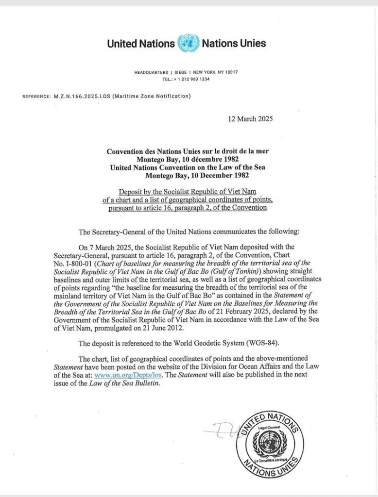
According to the UN Secretary-General’s announcement to member states dated March 12, 2025, Vietnam formally submitted these materials on March 7, 2025. The submission was made in accordance with Article 16, paragraph 2 of the 1982 United Nations Convention on the Law of the Sea (UNCLOS).
The deposited materials include a chart showing straight baselines and outer limits of the territorial sea, along with a comprehensive list of geographic coordinates of points for measuring the breadth of the territorial sea of Vietnam’s mainland territory in the Gulf of Tonkin.
On March 14, detailed information regarding Vietnam’s submission was published on the official UN website at www.un.org/Depts/los.
The UN announcement further indicated that the Vietnamese Government’s February 21, 2025 statement concerning the baselines for measuring territorial sea breadth in the Gulf of Tonkin will be included in the forthcoming issue of the UN’s “Law of the Sea Bulletin.”